/
Working with catchment scenarios
Working with catchment scenarios
- asatheesh (Unlicensed)
Owned by asatheesh (Unlicensed)
18 Apr 2014
Analytics
Loading data...
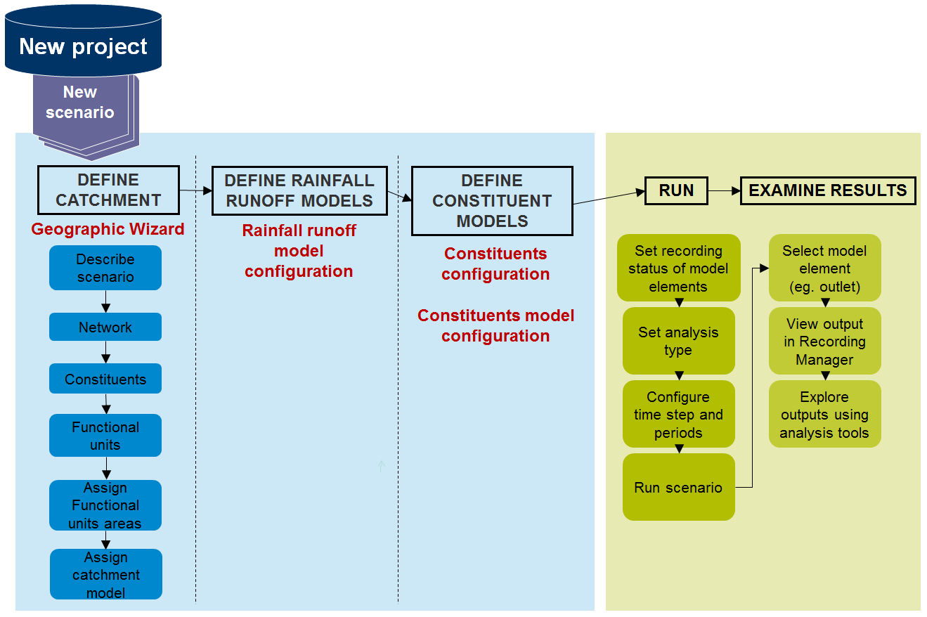
Catchment or geographic scenarios in Source are generated and managed using three distinct components, in the following order:
- The Geographic Wizard for catchments is used to define the catchment area and functional units;
- Assigning and paramterising rainfall runoff model (Rainfall runoff models); and
- Define, assign and parameterise constituents (refer to Constituents).
Figure 1 outlines the steps required to generate and run a catchments scenario.
Figure 1. Creating and running a catchments scenario
, multiple selections available,